


What you copy off a Garmin watch or a bike computer is often a .fit file, while Strava, some route planners, or Google Earth only accept GPX, TCX, or KML. A web search turns up plenty of “online converters,” and most of them want the file uploaded to their server first. A track log says where you went and when. A lot of people hesitate.
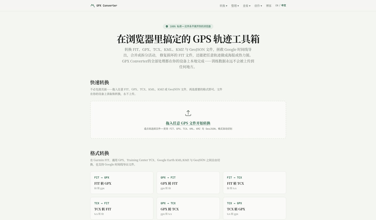
GPX Converter puts conversion, merge, split, preview, and simple repair in the browser, and does the work with JavaScript on your machine (in a Web Worker). The site documentation does not describe an upload API. It is free, needs no account, and has no usage cap that we saw. Below is a look at the product on November 11, 2026, plus a short-track hands-on test: how to use it, how to check the result, and what we actually inspected for the “no upload” claim. We used the Chinese page at gpxconverter.com/zh; the English site is the same converter.
Who it is for, and what it is not
It is a good fit if you regularly export tracks from a watch, a bike computer, or a phone workout app and then need another program to open them: a FIT file that has to go to a GPX-only platform, or a route you want to view in Google Earth. It does not replace a training archive such as Garmin Connect or Strava, and it is a poor place to keep your master activity library.
| Item | Details (researched November 11, 2026) |
|---|---|
| Address | gpxconverter.com (Chinese page: gpxconverter.com/zh) |
| Formats | FIT, GPX, TCX, KML / KMZ, GeoJSON, and Google Timeline exports to GPX |
| Cleanup | Merge / split GPX or FIT; repair common FIT header, CRC, or truncation problems (repair and Timeline were not in this hands-on test) |
| Preview and posters | Map, distance, climb, and pace preview; there are also track posters and heatmaps (those last two were not tested) |
| Price and account | Free, no signup; the site says there is no usage cap and no file-size paywall |
| Where it runs | The site claims everything is done locally in the browser. The privacy page notes that map tiles come from OpenStreetMap, and that there is also self-hosted Umami analytics and a Crisp chat widget (those are separate from the track file itself) |
| Operator | An independent site; the privacy page lists [email protected] as the contact |
The official site also notes that conversion speed depends on your own computer, and that once the page has loaded you can convert offline (the preview map may be missing tiles). Dropping in a very long training history at once can be slow or memory-heavy on a modest machine. That is a normal cost of doing the work in the browser, not an “upload queue.”
How to convert a track into the format you need
- Open the English homepage (or the Chinese page, if you prefer). You do not have to visit a “FIT to GPX” subpage first; the drop zone on the home page detects the format.
- Drop in a
.fit,.gpx,.tcx,.kml,.kmz, or.geojsonfile, or choose one from disk. - Pick the output format in the list, for example FIT→GPX, or GPX→KML for Google Earth.
- When the local conversion finishes, check the preview first: does the route on the map, the distance, the climb, and the elapsed time match the activity you remember? If they do not, do not download yet. Check whether you dropped the wrong file, or whether the original was already incomplete.
- Download the result and open it in the destination app to confirm again: are the points still there, and has the time shifted as a block? If the original had heart rate, cadence, or power, glance at those fields too — different formats keep different extensions, so do not assume “nothing is lost after one conversion.”
To join two recordings into one, or to cut a very long activity, use Merge and Split in the menu. When a FIT header is damaged, the CRC is wrong, or the recording was truncated, the site has a “Repair FIT” entry. Whether it can be fixed depends on how it broke, and you should still open the result and check it yourself. Google Timeline import was not tested this time; try it with your own export.
A short sample we actually converted
The test was on November 11, 2026. The file was not a real workout copied off a watch. It was a very short walking GPX written by hand around a public landmark — Baotu Spring (趵突泉), a park in Jinan, China — eight track points with elevation and a heart-rate extension, only to see whether formats would convert and whether the preview and export looked complete. It cannot stand in for the size or field coverage of “your two-hour ride.”
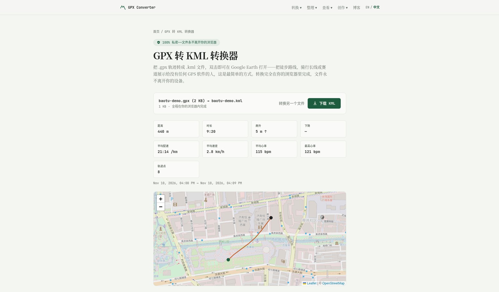
After converting that GPX to KML, the page reported: distance 440 m, duration 9 minutes 20 seconds (matching the timestamps in the file), climb 5 m, average pace 21:14 /km, average speed 2.8 km/h, average heart rate 115 bpm, max heart rate 121 bpm, 8 track points. The map preview lined up with the streets around Baotu Spring. In the exported KML, the latitude, longitude, and elevation of all eight points were still there, as were the original UTC timestamps; heart rate was not in the KML. If the next app needs heart rate, use GPX or FIT instead — do not expect the KML used by Google Earth to keep those extension fields.
The same sample GPX converted to FIT, then that FIT converted back to GPX, kept all 8 points, the timestamps, and all 8 heart-rate values. A few elevation figures drifted by about 0.1 m, for example 45.1 m becoming 45.2 m. That is ignorable for a walking preview; if you need elevation for careful analysis, compare again after converting. Merging two short GPX files also worked: 12 points, 615 m, 14 minutes. Heart rate from the first segment was still there; the second segment had none to begin with, and the merge did not invent any.
The page preview showed the time as Nov 10, 2026, 04:00 PM. That is the test browser’s time zone at the time (UTC-8) converting 2026-11-11T00:00:00Z, not the file being rewritten as November 10. In the exported KML / GPX, the timestamps were still the original UTC. Opening the same file in China’s time zone should show 8:00 a.m. on November 11. When you check, trust the timestamps in the file and in the destination app, not only the local display on the preview page.
On “the file never leaves the browser”: during the conversion we opened the Network panel in developer tools. We did not see a POST or other upload of the GPX file to a server. Outbound requests during the conversion included OpenStreetMap tiles (tile.openstreetmap.org, GET), the site’s own Umami analytics (umami.selenium39.me, POST, empty body), and Cloudflare’s /cdn-cgi/rum; the page also loads the Crisp chat widget. That matches the privacy page, and it only describes the network behavior of this session — it is not a guarantee about a later redesign, or about browser extensions you may have installed. We did not re-test offline. If you want extra assurance, turn on airplane mode after the page has loaded and convert once more (the preview map may be missing tiles, but the conversion itself should not fail for that reason).
Common failures and limits
- If the original is already truncated, the header is broken, or it is not a track file at all, conversion can fail or the preview can be blank. Repair is not a cure-all.
- Extension fields such as heart rate, cadence, and power do not always map one-to-one among GPX, FIT, TCX, and KML. In this short sample, GPX↔FIT kept heart rate; converting to KML did not. Always spot-check in the destination app.
- The browser has to read the whole file into memory. Dropping several large FIT files at once can freeze the page or crash the tab. In that case, do them in batches, or switch to a desktop tool.
- Map tiles need a network. Conversion itself, given the site’s design, can finish locally, but offline you may get the route without a basemap.
- This test did not use a real Garmin-exported FIT, and it did not cover Google Timeline, posters, heatmaps, or repairing a damaged FIT. Treat the official docs as the source for those, and try them yourself before relying on them.
How to choose among other options
If you need to batch-convert many files on a computer, or you want finer control over fields, the desktop tool GPSBabel is still a common choice, though you have to install it and the interface is more technical. If you are converting images, Office files, PDFs, or video, the tools already covered on this site are a different job: Filee and Open Tangerine (EN pending) handle general file formats, pdf.iceai.cloud handles PDFs, and Make Video Smaller (EN pending) shrinks a video to a target size in the browser, also with an emphasis on not uploading. GPX Converter only solves “change a workout track’s format, and try not to hand the route over to someone else.”
Some platforms also convert on import or export (Garmin, Strava, and so on). That is conversion inside an account, and the route goes into that platform. It is not the same kind of approach as this no-account web page.
Bottom line
If the problem is “this FIT or GPX is not accepted by the next app, and I do not want to upload a full trip log to a random converter,” start at GPX Converter, try a short, non-sensitive file, check that the preview and the export match, and glance at the Network panel yourself for an upload. Only then process a real training file. Whether the fields are complete, and whether a large file will run on your computer, has to be judged with your own files.


