


Reading Chinese history (or memorizing Tang poems) often stalls on two questions: what is this ancient city called today, and where is it? and what did the map look like in that year?
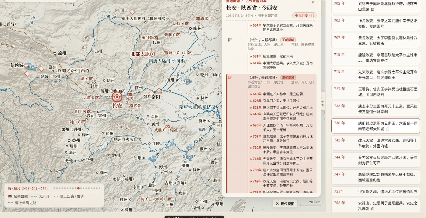
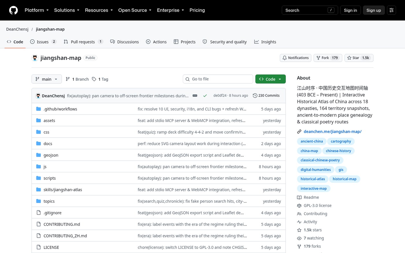
江山时序 — English name Chronicles of the Realm / repo jiangshan-map — packs roughly 2,400 years (from the Partition of Jin in 403 BCE to the present) and 18 historical periods into a browser atlas you can scrub with a timeline: click a city for administrative lineage, follow a figure’s itinerary, or overlay modern provincial borders with a “perspective” layer. Live: deanchen.me/jiangshan-map; repo: DeanChensj/jiangshan-map. Researched October 27, 2026.
At a glance
| Item | Details |
|---|---|
| Type | Browser interactive atlas of Chinese historical borders, cities, and itineraries |
| Version | v1.0.0 (Release October 17, 2026; ~1,490 stars when checked) |
| License | GPL-3.0 (README notes: some CHGIS / Hartwell admin-boundary data stay under original academic / non-commercial terms, not GPL) |
| Platform | Modern browsers; local demo deploy possible; also a zero-dep MCP server / agent skill |
| Price | Free open source; online demo playable without signup |
| UI language | Simplified Chinese / Traditional Chinese / English (?lang=) |
| Stars | About 1,490 when checked |
| Online | deanchen.me/jiangshan-map |
| Repo | github.com/DeanChensj/jiangshan-map |
What you can do
Per the official bilingual README, four main tracks:
- Scrub the timeline: Warring States through modern maps (including familiar China-outline metaphors such as the “begonia leaf” → “rooster” shapes used in Chinese education) with multiple regimes on screen; major expansion/loss stages leave a cinnabar dashed ghost of the previous stage. The timeline syncs reigning emperors and era names.
- Click a city / double-click · Trace Place: ~18 dynasties of admin lineage, events, and today’s place name; famous passes, battlefields, and poetry sites are clickable.
- Follow a person: search Qin Shi Huang, Zhang Qian, Zhuge Liang, Xuanzang, Li Bai, Su Shi, Wang Yangming, and others; the map advances stop by stop as era names and borders shift with them.
- Map pin quiz: ten rounds of clues + blind pin drops, scored by great-circle distance, with a playful traditional cartographer-style title.
Shareable deep links (?year=, ?place=, ?person=, ?quiz=) plus LLM/MCP helpers (llms.txt, local mcp_server.js with inspect_place / inspect_person / search_atlas).
How it sits next to related pieces on this site
| Need | Better fit |
|---|---|
| 3D globe for flights / ships / satellites | God’s Eye View (EN pending) |
| IELTS vocab memory web tool | Word Atlas (EN pending) |
| Open-source alternatives roundup entry | Open-source alternatives (Chinese) — EN pending |
| Chinese history space-time, city lineage, itineraries on one map | Chronicles of the Realm / Jiangshan Map |
The project is explicit: borders and prefecture lines are schematic approximations for grasping political reach — not survey-grade GIS. Sources include Tan Qixiang’s Historical Atlas of China, CHGIS, Hartwell, and similar. For papers, go back to the original atlases and databases.
Who it is for (and who should skip)
Good fit: reading Chinese history or prepping exams and wanting “where was this city / what did that year look like”; teachers or creators who need shareable deep links; people wiring Claude / Cursor to a historical-geography MCP.
Skip for now: you need GIS-precise boundaries or commercial basemaps; you cannot accept GPL-3.0 plus academic non-commercial data clauses; you only want a one-tap App Store install — the main entry when checked is the web app.
Try it live: deanchen.me/jiangshan-map/?year=741&place=长安 (Kaiyuan 29 · Chang’an). Version and features follow the October 27, 2026 README / v1.0.0 check.


